MTB Routes
Tagus Nature Trail
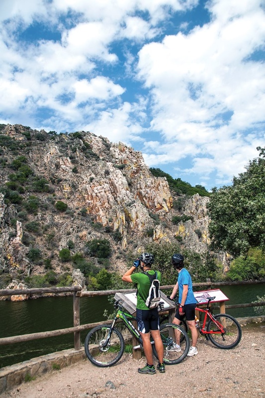
At the banks of the Tagus River
- Extremadura BTT
- MTB routes
- Nature trails
- Tagus Nature Trail
MTB Routes
Tagus Nature Trail
At the banks of the Tagus River
The Tagus Nature Trail runs for over 850 km from its start in the Teruel province until its end at Cáceres, passing through Guadalajara, Madrid and Toledo. A journey in the footsteps of the longest river of the Iberian peninsula, whose final stages, exactly 355 km, pass through Extremadura.
Prepared for MTB, the stages in Extremadura are divided into total eight ranging between 40 and 60 km length each, following for the most part the signposted track of the GR 113 path but including the necessary alternative tracks to overcome the obstacles that along the way inhibit MTB.
Downloads
STAGE 1: Puente del Arzobispo – Villar del Pedroso – Valdelacasa del Tajo – Garvín
The stage begins at Puente del Arzobispo, the provincial border between Cáceres and Toledo. The route runs towards the south parallel to the EX-387 road toward Villar del Pedroso, a town where you may visit the Carnaval de Ánimas Interpretation Centre, a deep-rooted local festival.
The stage continues on the los Huertos road with the Altamira mountain range facing you at all times. A route that links with the Valdelacasa to Carrascalejo path, an area where meadows start to appear with low hill areas until you reaching Valdelacasa de Tajo. We will leave this town to take the Peraleda de San Román path, crossing the Zarzalejos stream and go towards Garvín, end of the stage.
Downloads
- KML file of the stage
- Topographical guide of the stage
- Map of the stage
STAGE 2: Garvín – Peraleda de San Román – Bohonal de Ibor
The stage starts at Garvín and goes on the Camino Real to Peraleda San Román. Next to the Gualija river bridge the route deviates from the original track of the Tagus Nature Trail to follow the Fresnedoso path, which after a steep climb leads to the raña de las Mesillas, an important geosite that we will find in the surroundings of the Villuercas-Jara Geopark.
At this point, the stage joins the Passage Through Geopark route. Thus, it takes the Navalmoral de la Mata to Castañar Ibor path and goes down the valley unto Bohonal de Ibor. The Roman ruins of Augustóbriga are located about 2 km off the track to the north of this town on the shores of the Valdecañas reservoir.
Downloads
- KML file of the stage
- Topographical guide of the stage
- Map of the stage
STAGE 3: Bohonal de Ibor – Mesas de Ibor – Valdecañas del Tajo – Higuera de Albalat – Serrejón – Toril
The stage starts at Bohonal de Ibor on the CC-19 road to reach the Ibor river near the Veredas bridge. The route continues parallel to the road up to Mesas de Ibor, where an asphalted stretch a cemented track begins that will lead us to Valdecañas de Tajo. From here the path continues along the CC-148 road, on a stretch which is not signposted as a Nature Trail.
At the Garganta de Descuernacabras natural swimming pool, an ideal space to take a break, a steep climb begins until reaches the Higuera de Albalat town.
From this last point, over the Almaraz path, passing through a landscape of beautiful oak tree meadows; we will arrive at Albalat bridge, with the Tagus river crossing. After passing the Arrocampo reservoir towards Serrejón, we will enter the Monfragüe Biosphere Reserve. Finally, the route continues up to Toril, end of the stage.
Downloads
- KML file of the stage
- Topographical guide of the stage
- Map of the stage
STAGE 4: Toril – Villarreal de San Carlos – Serradilla
This stage begins at Toril, where the Monfragüe Biosphere Reserve Interpretation Enter is located. A remarkable oak trees meadow will accompany the cyclist for about 10 km, until the road that connects La Bazagona with Saltos de Torrejón. Very close to this point, you may enjoy the first vantage point in the area, the impressive Portilla del Tiétar, where it is easy to spot species such as the imperial eagles, griffon vultures, black stork and eagle owl.
The route continues until reaching Villarreal de San Carlos, the nerve centre of the Monfragüe National Park, where there is an Information Office and several interpretation centres related to this natural area.
From here the route diverts from the GR 113 path until the end of stage in Serradilla. The flight of birds of prey will always accompany us and it wont be a surprise if we come across deer's, therefore we must take extra precautions.
Downloads
- KML file of the stage
- Topographical guide of the stage
- Map of the stage
STAGE 5: Serradilla – Casas de Millán – Cañaveral – Garrovillas de Alconétar
The stage starts at Serradilla on the old Talaván path until reaching Casas de Millán. From here the route continues to the west meeting the high-speed railway line for the first time, just where the route leaves the Monfragüe Biosphere Reserve to reach Cañaveral.
From this point the route turns to the south and joins the Via de la Plata track. Once on the shores of the Alcántara reservoir, the stage joins the the N-630 to successively cross the riverbeds of the Tagus and Almonte rivers.
The route continues until reaching the Garrovillas de Alconétar town, end of the stage. Viewing its arcaded square, declared as an historic-artistic monument will impress you.
Downloads
- KML file of the stage
- Topographical guide of the stage
- Map of the stage
STAGE 6: Garrovillas de Alconétar – Mata de Alcántara – Alcántara
The stage starts at Garrovillas de Alconétar crossing the Pinares de Garrovillas Special Bird Protection Area, an interesting stretch of umbrella pine forest that are used by species such as the black stork to reproduce. The town itself boasts of this environmental protection for the colony of lesser kestrel present in the vicinity of its square and church.
We will descend unto the shores of the Alcántara reservoir. After crossing Mata de Alcántara, the route takes the Recovera path, at which point you may once again see the reservoir water and go towards Alcántara, end of the stage.
This town, apart from the magnificent Roman Bridge, declared as the Best Corner of Spain in 2014; also has a very important monumental complex, notable the San Benito Convent. Alcántara is also a gateway to the Tagus International Natural Park, and the visitors may visit its Interpretation Centre in this town of Cáceres.
Downloads
- KML file of the stage
- Topographical guide of the stage
- Map of the stage
STAGE 7: Alcántara – Membrío – Carbajo
The stage starts at Alcántara following the Cañada Real de Gata to enter the plains of Brozas and Alcántara. During the journey the visitor may spot the flight of great bustards, bustards, and Montagu's harriers, among other species. All birds that live in the nearby Tagus International Natural Park.
The route gently goes ahead to descend the Salor river to enter the natural space mentioned above. The climb is of continuous ascent unto Membrío, always with the foothills of the Sierra de San Pedro mountain range dominating the skyline. At this point in the path its will be quite habitual to encounter herds of deer. The route continues until reaching the Carbajo town, end of the stage.
Downloads
- KML file of the stage
- Topographical guide of the stage
- Map of the stage
STAGE 8: Carbajo – Santiago de Alcántara – Herrera de Alcántara – Cedillo
The stage starts at Carbajo until reaching Santiago de Alcántara. In this town of Cáceres one may visit two interpretation centres: Péndere, intended to showcase the various environmental and scenic treasures of the Tagus International Natural Park; and Megalithic, that gathers information on the important dolmens site of the municipality.
The route starts at Santiago over the Cedillo path, a track that passes through meadows and scrubland until reaching the town of Herrera de Alcántara. This municipality is where the main jetty of Balcón de Tajo, the tourist boat that offers river tours through the natural park.
Owing to cycling issues, from Herrera onwards the route deviates from the nature trail to go towards Cedillo on the EX-116 road initially and the CC-125 later, where both the stage and the route end.
Downloads
- KML file of the stage
- Topographical guide of the stage
- Map of the stage